Cook, Fake News and Admiralty
Not until his Journal was published in the 1880s, was there any alternative narrative to what was published when Cook was away on his 2nd Voyage.
Commissioned by the Admiralty, book publisher and editor John Hawkesworth's version of events was more fiction than fact. Fake News is nothing new.
"After the release of the publication, Hawkesworth was heavily criticised for his editorial work. The ‘Account’ was called inaccurate, lewd, boring, sloppy, pompous, bad value and irreligious. The captains whose journals he edited attacked him for tampering with their accounts. Cook himself famously disliked the finished product, in particular Hawkeworths’ moralising and habit of drawing “a general conclusion from a particular fact”. As Editor Hawkesworth sometimes used his own material, not that of the journal writers themselves." [1]
May I suggest here that Hawkesworth may have made alterations at the request of the Admiralty which had commissioned the publication.
Cook gets praised for his abilities and his part in Britain claiming New Holland, now called Australia.
This latter part hinges on some proclamation he supposedly made in August 1770, but the evidence to support this proclamation is lacking. It would have been against his 'Instructions' to do so, and there are no supporting writings by Joseph Banks who was said to accompany Cook to the small hill where this proclamation supposedly occurred, nor by the diaries of any other people on the Endeavour.
Curious too that the only published account of Cook's 1st Voyage was commissioned by the Admiralty and written by a “publisher” who wrote as if he was Cook himself. This was published while Cook was away on his 2nd Voyage, and his actual Journals didn't become public for over a century. So here's an alternative narrative.
The story begins at the Royal Society in 1768 when members wanted to work out how far away we are from the sun. They decided that if they could measure the transit of Venus across the Sun from two separate vantage points here on earth, they could work it out. With the once in 70 years next Venus transit due in 1769, they quickly decided that Oslo and Tahiti, a newly “discovered” (sic) land charted by Captain Samual Wallis the year before, would be two ideal vantage points, both in daylight with the sun visible at the time of the transit.
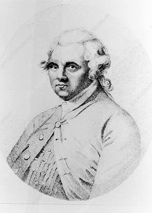
Alexander Dalrymple
Alexander Dalrymple, hydrographer for the British East India Company and Royal Society member wanted to lead the mission to Tahiti, and then to continue the voyage to search for the land of great extent thought to exist In the southern hemisphere, to balance with the land masses of the northern hemisphere. Dalrymple believed that the western coast of New Zealand, as mapped by Abel Tasman over a century prior, may be the western coast of some unknown great Terra Australis Incognito.
Dalrymple had acquired various early Portuguese and Spanish Maps when in the Philippines, and had also mapped surrounding areas.
Perhaps because the Admiralty didn’t want the British East India Company gaining any more lands and power, or because French explorer Bougainville had claimed more Pacific Islands for France, or for some other reason, the Admiralty decided to have Dalrymple replaced by Navy Lieutenant Cook to captain the expedition to Tahiti. Cook was entrusted with further “secret” Orders to be opened only after the viewing of the Venus transit had been completed in Tahiti.
Botanists from the Royal Society as well as the society’s assistant astronomer Charles Green were to be onboard for the planned “scientific expedition” but Alexander Dalrymple was excluded, some say he only wanted to be Captain and refused to just be a subordinate officer, but he was certainly aggrieved.
After successfully completing the astronomical observations, Cook presumably then opened his “Secret” Instructions which were to attempt to discover this as yet unknown southern continent thought to be in the southern Pacific. Cook’s Instructions were informed by Dalrymple’s ideas about where this great south land may be, so per Instructions, the Endeavour sailed south until at the latitudes Tasman had charted as New Zealand. They hadn’t encountered any land, so, as per Orders, turned left and sailed west, not knowing when or where they would reach land fall.
Cook's Instructions extract:
Whereas there is reason to imagine that a Continent or Land of great extent, may be found to the Southward of the Tract lately made by Captn Wallis in His Majesty’s Ship the Dolphin (of which you will herewith receive a Copy) or of the Tract of any former Navigators in Pursuit of the like kind, You are therefore in Pursuance of His Majesty’s Pleasure hereby requir’d and directed to put to Sea with the Bark you Command so soon as the Observation of the Transit of the Planet Venus shall be finished and observe the following Instructions. You are to proceed to the Southward in order to make discovery of the Continent abovementioned until’ you arrive in the Latitude of 40°, unless you sooner fall in with it.
But not having discover’d it or any Evident sign of it in that Run you are to proceed in search of it to the Westward between the Latitude beforementioned and the Latitude of 35° until’ you discover it, or fall in with the Eastern side of the Land discover’d by Tasman and now called New Zeland (sic).
If you discover the Continent abovementioned either in your Run to the Southward or to the Westward as above directed, You are to employ yourself diligently in exploring as great an Extent of the Coast as you can carefully observing the true situation thereof both in Latitude and Longitude, the Variation of the Needle; bearings of Head Lands Height direction and Course of the Tides and Currents, Depths and Soundings of the Sea, Shoals, Rocks &ca and also surveying and making Charts, and taking Views of Such Bays, Harbours and Parts of the Coasts as may be useful to Navigation. You are also carefully to observe the Nature of the Soil, and the Products thereof; the Beasts and Fowls that inhabit or frequent it, the Fishes that are to be found in the Rivers or upon the Coast and in what Plenty and in Case you find any Mines, Minerals, or valuable Stones you are to bring home Specimens of each, as also such Specimens of the Seeds of the Trees, Fruits and [FIRST PAGE ENDS] and Grains as you may be able to collect, and Transmit them to our Secretary that We may cause proper Examination and Experiments to be made of them. You are likewise to observe the Genius, Temper, Disposition and Number of the Natives, if there be any and endeavour by all proper means to cultivate a Friendship and Alliance with them, making them presents of such Trifles as they may Value inviting them to Traffick, and Shewing them every kind of Civility and Regard; taking Care however not to suffer yourself to be surprized by them, but to be always upon your guard against any Accidents.
You are also with the Consent of the Natives to take Possession of Convenient Situations in the Country in the Name of the King of Great Britain: Or: if you find the Country uninhabited take Possession for his Majesty by setting up Proper Marks and Inscriptions, as first discoverers and possessors.[2]
Note that the final paragraph of the Instructions relates to some unknown land east of New Zealand. It does not relate to New Holland.
It appears that Cook followed his Instructions dutifully. They traveled south, then went westward. Finally they sighted New Zealand and for the next six months accurately charted the two major islands, proving that New Zealand was not part of some land of great extent.
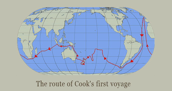
To fulfill his Instructions, Cook wanted to go back across the Pacific, but further south, to establish once and for all, whether the Terra Australis Incognito existed. However, as his journal records on 31st March 1770, Cook called together the Officers on board the Endeavour for a meeting.
To complete the search as per Orders would mean going back across the southern parts of the Pacific, and with winter approaching, it would be a perilous journey. This was especially so since the rigging and sails were already worn and torn, so they decided to keep going west until they “fall in with the east coast of New Holland”, then follow the coast north, until they get to the strait that separates New Holland from New Guinea, and then sail further west until they reach Batavia for repairs.
From Cook's “Official” Journal:
“Saturday, 31st. In the P.M., after rowing a League and a half” etc., snipped
Upon my return to the Ship, in the Evening, I found the Water, etc., all on board, and the Ship ready for Sea; and being now resolv'd to quit this Country altogether, and to bend my thought towards returning home by such a rout as might Conduce most to the Advantage of the Service I am upon, I consulted with the Officers upon the most Eligible way of putting this in Execution. To return by the way of Cape Horn was what I most wished, because by this rout we should have been able to prove the Existance or Non-Existance of a Southern Continent, which yet remains Doubtfull; but in order to Ascertain this we must have kept in a higher Latitude in the very Depth of Winter, but the Condition of the Ship, in every respect, was not thought sufficient for such an undertaking. For the same reason the thoughts of proceeding directly to the Cape of Good Hope was laid aside, especially as no discovery of any Moment could be hoped for in that rout. It was therefore resolved to return by way of the East Indies by the following rout: upon Leaving this Coast to steer to the Westward until we fall in with the East Coast of New Holland, and then to follow the direction of that Coast to the Northward, or what other direction it might take us, until we arrive at its Northern extremity; and if this should be found impracticable, then to Endeavour to fall in with the Land or Islands discovered by Quiros.*”(* Quiros, a Spanish navigator, discovered in 1605 Espiritu Santo, the northern island of the New Hebrides, which he supposed to be a part of a great southern continent. Cook, in his second voyage, thoroughly explored the New Hebrides group; and for some of the islands his charts are still the only guide.)With this view, at daylight we got under Sail and put to Sea, having the Advantage of a fresh Gale at South-East and Clear weather. At Noon the Island, which lies off the North-West point of the Bay, bore East 9 degrees South, distant 10 Miles; our Latitude, by Observation, was 40 degrees 35 minutes South. This bay I have named Admiralty Bay; the North-West point Cape Stephens, and the East Point Jackson, after the 2 Secretarys.* (* The two secretaries of the Admiralty, Philip Stephens and George Jackson, both of whom showed great appreciation of Cook.) It may always be known by the Island above mentioned, which is pretty high, and lies North-East, 2 Miles from Cape Stephens; Latitude 40 degrees 37 minutes South; Longitude 185 degrees 6 minutes West. Between this Island and Cape Farewell, which is West by North and East by South, distant 14 or 15 Leagues from each other, the Shore forms a large deep Bay, the bottom of which we could hardly see in sailing in a Strait line from the one Cape to the other; but it is not at all improbable but what it is all lowland next the Sea, as we have met with less water here than on any other part of the Coast at the same distance from Land; however, a Bay there is, and is known on the Chart by the Name of Blind Bay, but I have reason to believe it to be Tasman's Murderers' Bay.* (* Blind Bay is now also known as Tasman Bay, and Massacre Bay is supposed to be a smaller bay in it, on the north-western side.)
Before I quit this land altogether I shall give a short general description of the Country, its inhabitants, their manners, Customs, etc., in which it is necessary to observe that many things are founded only on Conjecture, for we were too short a time in any one place to learn much of their interior policy, and therefore could only draw conclusions from what we saw at different times. [3]
It’s strange that this decision to head towards New Holland rather than Cook stick to his Instructions is glossed over. Perhaps it's because the text above is in the chapter concerning New Zealand, rather than as part of the next chapter, “CHAPTER 7. PASSAGE FROM NEW ZEALAND TO NEW HOLLAND.” which begins from the next day, April 1st, 1770 (see Captain Cook's Journal. First Voyage - ( 2/3rds down page)
The story of the Captain Cook heading up the east coast of New Holland is much more widely known. Their first stop was at Botany Bay after skirting the coast for about 200 kilometers. It is said that Cook planted the British flag there, and had initials and a date inscribed into a tree. This is recorded in Cook’s “Official” Journal, but only as an entry after they had already left what Cook initially called Stingray Bay, later to be called Botany Bay, and only mentioned when they were sailing further north. It is not corroborated by the diaries of Banks or others, and no-one appears to have identified this inscribed tree since. Surely it would be a “sacred object” to Australians, if it was ever “discovered”.
There were a further two places in present day Queensland, where some of the crew went ashore to search for fresh water, and Cook also went ashore at Seventeen Seventy (near Gladstone) and again near present day Cooktown. Then they hit the reef and had to do an emergency stop to get some wood to repair the damaged ship. Essentially, the stopovers were to try to find fresh water, and to give Banks and Solander chances to collect and document natural history specimens.
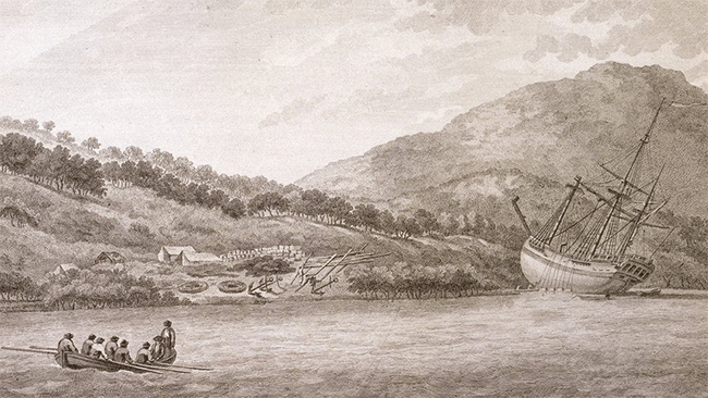
Repairing the Endeavour after reef damage near what is now known as Cooktown
And then they hit the reef. Once they got sailing again after make-shift repairs to their boat, when they reached what they thought could be the strait they were hoping for, to get a better view, they went ashore on a small island, a rocky outcrop with a small hill which Cook, Banks and others ventured up. From here they could see clear waters to the west, so Cook was sure he was in a strait, not a bay or river, hence he named the place Passage Island. This name was later amended to Possession Island and Cook is said to have made some grand proclamation from here, claiming the whole east coast he had mapped, and calling it New South Wales. This proclamation is not corroborated with anyone else’s diaries, which seems odd, since it’s now seen as the most significant event of Cook’s 1st Voyage. There are some diary entries where it’s written that Cook claimed the country, but presumably, the country means that small island, since even the wording of the official proclamation is to a coast, bays inlets and adjacent islands, not the country as such. Presumably, one would have to actually be on a coast to claim it, but this too is seldom mentioned.
Here's what Cook's Journal says is the proclamation:
Having satisfied myself of the great Probability of a passage, thro' which I intend going with the Ship, and therefore may land no more upon this Eastern coast of New Holland, and on the Western side I can make no new discovery, the honour of which belongs to the Dutch Navigators, but the Eastern Coast from the Latitude of 38 degrees South down to this place, I am confident, was never seen or Visited by any European before us; and notwithstanding I had in the Name of his Majesty taken possession of several places upon this Coast, I now once More hoisted English Co, and in the Name of His Majesty King George the Third took possession of the whole Eastern coast from the above Latitude down to this place by the Name of New Wales,* (* The Admiralty copy, as well as that belonging to Her Majesty, calls it New South Wales. The island where the ceremony was performed was named on Cook's chart Possession Island, and is still so called.) together with all the Bays, Harbours, Rivers, and Islands, situated upon the said Coast; after which we fired 3 Volleys of small Arms, which were answer'd by the like number from the Ship.
In Part it states “In the Name of his Majesty taken possession of several places upon this Coast” yet the documented track record up the coast doesn't support this.
Cook’s Instructions, although intended for some unknown land he had thus far failed to locate, were to only make a claim “with the Consent of the Natives”. It doesn’t seem like he even tried to gain the consent of the Natives of New Holland, which seems quite likely the case since it was not even part of his Instructions to go anywhere near New Holland.
It should be noted that Cook was sent on a 2nd Voyage three years later, a year after he got back from this 1st Voyage, to search the southern pacific for the postulated Terra Australis, so as to complete his initial “secret” instructions.
Cook probably was the first European to sight the east coast of New Zealand, but he didn't claim that for his King even though it was within his Instructions to go there, and yet we are told he claimed the east coast of New Holland when he was on an offshore island on the western side of Cape York.
When sailing beyond Torres Strait, officially named by Dalrymple when Cook was still on his 1st voyage, Cook writes of dissatisfaction with the maps and charts he had brought with him, where islands were not in their right place, and locations on New Guinea were written in Portuguese and Dutch.
Torres Strait was named by Dalrymple in his book:
“Historical Collection of the Several Voyages and Discoveries in the South Pacific Ocean“
published in 1770, just when Cook was returning to England, thus Cook named it Endeavour Straits, but he was too late. Since it already had a European name.
Dalrymple’s Book published in 1770, which in it’s preface begins with:
“Above two years ago I printed a few copies of a tract on ‘The Discoveries made in the South Pacific Ocean’, however I did not publish til lately when it was reported that the French had discovered the continent.”
Then at preface page xv:
“I confined myself to the discoveries made between SOUTH AMERICA and PAPUA.”
Before Cook had been appointed to replace Dalrymple, Banks was shown Dalrymple’s collection of Maps, most notably the Dieppe Maps, which he uncovered in the Philippines a few years before.
No-one seems to know which Maps and Charts Cook took with him on board the Endeavour.
There are various writings of Portuguese or Spanish Ships , as well as Chinese ships being on the east coast, but in the Possession Island Proclamation, Cook writes that he was the first European to do so.
Did Cook really think that? He may have been the first to accurately chart the east coast, but that's not the same thing.
Cook and crew noted how interaction with the New Hollanders didn't go too well. He noted how the women and children were shielded by the men. It's as if the locals knew only too well about the likely dangers when sailing ships arrive, so the women and children went into hiding and were protected.
Because all the Journals and diaries from the First Voyage were embargoed by the Admiralty, Cook remained an obscure Navy Lieutenant between his 1st and 2nd voyages.
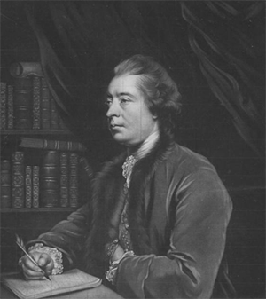
John Hawkesworth
Meanwhile, the Admiralty had already commissioned a new book about the exploits of Commodore Byron, Captain Wallis and Captain Carteret about their recent “discoveries” in the Pacific. They sent publisher John Hawkesworth copies of Cook’s and Banks’ writings of the Endeavour Voyage to include in his upcoming publication. Hawkesworth’s book became a 3 volume set, two of which were devoted to Cook’s 1st Voyage. The published account writes in the first person, as if it is Cook himself doing the writing. Cook was away at sea when this was published, and only found out about these volumes when he was returning from his 2nd Voyage.
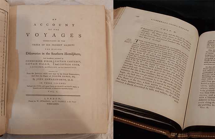
An Account of the Voyages undertaken by order of his present Majesty. for making discoveries in the Southern Hemisphere and performed by Commodore John Byron, Captain Wallis, Captain Carteret and Captain Cook (from 1702 to 1771) drawn up from the Journals ... (3 vols, 1773)
It’s all available online here, where the Stingray/Botany Bay encounter is detailed over several pages.at the end of the chapter [4]
In referring to Botany Bay:
“I caused the English Colours to be displayed on shore everyday”
The Possession Island Proclamation is surprisingly unlike much of Hawkesworth's account of Cook's Voyage, as the Possession Island Proclamation is very close to word for word with Cook’s “official” Journal.
 Enlarge
John Hawkesworth’s ‘An Account of the Voyages … [of] Captain Cook - (left) frontispiece museum's copy of vol 1 (right) Vol 2, open to 11 October 1869 (Source: Taira Whiti Museum, Aotearoa / New Zealand)
The publishing of this 3 volume set was an instant success, although there was much complaint from the critics, especially about the behaviour of the crew in Tahiti, and that readers couldn't tell whether it was Cook, Banks or Hawkesworth writing it, it immediately became the most borrowed book(s) from various Public Libraries in England. This was while Cook was still away on his 2nd Voyage.
The language used in the “Possession Island Proclamation” is in a more formal form of language than was Cook’s usual working class phrasing. Interesting too, that it is within this Proclamation is the only time Cook refers to the east coast of New Holland by the name New South Wales.
To add further doubts to the proclamation happening as recorded,is that despite Cook’s penchant for naming all sorts of places on his 3 voyages, the only time he didn’t name someplace as being either descriptive of a geographic feature or else a name to honour a person of rank, was in this naming of New South Wales or New Wales said to have been done in this proclamation.
There was already New Guinea, New Britain, New Holland, and all these other “New …..someplace else” but these were not named by Cook. It appears that he had an aversion to this way of naming a supposed “discovery” so he chose other ways to name places, that except in the Possession Island Proclamation.
Odd too that the Historical debate is obscured by questions of whether Cook named the east of coast of New Holland New Wales or New South Wales, when the real debate should be about whether Cook called it any name other than New Holland.
That none of the writings from Banks or any of the others on the Endeavour mention this grand proclamation claiming the east coast of New Holland for King George the 3rd does suggest it never actually happened, but was included by the Admiralty in their commissioning of Hawkesworth to write something more advantageous to British colonial interests and get it published before Cook finds out about it.
Indeed, it's not just my analysis. Soon after Hawkeworth's account of Cook's adventure was published, Dalrymple wrote some scathing letters to Hawkesworth accusing him of making things up, which Hawkesworth denied. Perhaps it wasn't Hawkesworth who made some things up.[5]
The much maligned Dalrymple also questioned whether Cook was the first European to sight the east coast of New Holland. It was in 1786, after Cook had been killed in 1779, when examining the Harleian map in the manuscript collection of Edward Harley, second earl of Oxford, Dalrymple noted: ''The East Coast of New Holland as we name it, is expressed with some curious circumstances of correspondence to Captain Cook's MS (manuscript).
Dalrymple drew the conclusion that Cook had apparently not been the first to chart the east coast of Australia. Dr Daniel Solander, the botanist on Cook's first voyage and keeper of the Natural History Department of the British Museum, lent the map to Dalrymple, who saw an opportunity to challenge Cook's priority of discovery of the east coast of Australia.[6]
Then there's this:
Alexander Dalrymple is accredited with having made the first reference to one of the Dieppe maps in his pamphlet Memoir concerning the Chagos & adjacent islands (London, 1786), in which he implied that Cook had known of the existence of the map and used it in his charting of the east coast of Australia. He claimed, for instance, that the Coste de Herbiages (Coast of Vegetation) on the Dieppe map corresponded to Cook's Botany Bay.[7]
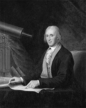
Cowley who wrote the linked article [7] goes on to state that it was R H Major, keeper of Maps at the British Museum that pushed the “Portuguese Discovery” idea.
Unfortunately for Dalrymple, 1786 was not a good time to be challenging Cook’s “discovery” since the Crown was making plans to send convicts to “New South Wales” with some public backlash about such a “Transportee Solution” already. Thus, it's been in the interests of the Crown to talk up Cook as the great navigator and “discoverer”.
Such aggrandisement of Cook has forgotten that it was astronomer Charles Green that calculated all the longitudes for Cook's Maps and Charts.
Also, in the words of M. Barbie du Bocage at the Institute of France in 1807, in reference to earlier Portuguese Maps:
The English pretend that none of these charts existed until after the death of the celebrated Captain Cook; and they had no knowledge of them when this navigator set sail. But their prior existence in well-known libraries in England may cause this assertion to be doubted.[8]
As it turns out, Alexander Dalrymple claims he had already told Joseph Banks about these maps in 1768, so when the Endeavour returned from Cook’s first voyage, Dalrymple complained that Cook had made no new discoveries:
Dalrymple was on friendly terms with Sir Joseph Banks for many years , as in 1768, he gave him a copy of his Early Discoveries.[9]
Everything Changes after the 2nd Voyage.
When Cook returned from his 2nd Voyage he was celebrated as a National Hero. He was introduced to the King. He was awarded a Copley Medal for his work to keep the crew free of scurvy. This acclaim was because of the published account of his 1st Voyage which he didn't even know about until after it had become widely known throughout England.
Cook was hardly in a position to dispute the idea that he claimed the east coast of New Holland for his King. How could he? The most probable explanation of events is that Cook was ordered to amend the Journal of his 1st Voyage, so it matched the story already published by Hawkesworth, as commissioned by the Admiralty.
Because anything other than Hawkesworth's account of Cook's 1st Voyage was not available, Cook's “Official” Journal could have been further doctored many years later. The “Proclamation” in his Journal is said to have been written by Cook's own hand, which is not to say other parts could not be altered even after Cook's death.
Regardless of whether it was Cook or the Admiralty that wrote the Possession Island Proclamation, it was, at best, only a claim to a Radical Title, not a claim to any of the territory of New Holland beyond the coast, waters and uninhabited islands adjacent. Just like much of the northern, western and southern coasts of New Holland had long been claimed by the Dutch, Britain wanted to prevent the French from doing so for the east coast, or worse, starting a colony there. It seems that the radical title to the east coast was done from London and fraudulently attributing it to Cook by adapting where he claimed a small off-shore island he's called Passage Island and changing to Possession Island and making it into a claim to the whole east coast of New Holland. Cook wasn't even on the east coast at the time, nor was it part of his Instructions to go anywhere near New Holland.
Further, when Cook and crew were at Batavia awaiting repairs, this is what he arranged to be sent back to the Admiralty in London. It's a brief summary starting from when leaving Tahiti in 1769:
It was the 13th of July before I was ready to quitt this Island, after which I spent near a month in exploring some other Islands which lay to the Westward, before we steer'd to the Southward. On the 14th of August we discovered a small Island laying in the Latitude of 22 degrees 27 minutes South, Longitude 150 degrees 47 minutes West. After quitting this Island I steered to the South, inclining a little to the East, until we arrived in the Latitude 40 degrees 12 minutes South, without seeing the least signs of Land. After this I steer'd to the Westward, between the Latitude of 30 and 40 degrees until the 6th of October, on which day we discovered the East Coast of New Zeland (sic), which I found to consist of 2 large Islands, extending from 34 to 48 degrees of South Latitude, both of which I circumnavigated. On the 1st of April, 1770, I quitted New Zeland (sic), and steer'd to the Westward, until I fell in with the East Coast of New Holland, in the Latitude of 30 degrees South. I coasted the shore of this Country to the North, putting in at such places as I saw Convenient, until we arrived in the Latitude of 15 degrees 45 minutes South, where, on the night of the 10th of June, we struck upon a Reef of Rocks, were we lay 23 Hours, and received some very considerable damage. This proved a fatal stroke to the remainder of the Voyage, as we were obliged to take shelter in the first Port we met with, were we were detain'd repairing the damage we had sustain'd until the 4th of August, and after all put to Sea with a leaky Ship, and afterwards coasted the Shore to the Northward through the most dangerous Navigation that perhaps ever ship was in, until the 22nd of same month, when, being in the Latitude of 10 degrees 30 minutes South, we found a Passage into the Indian Sea between the Northern extremity of New Holland and New Guinea. After getting through the Passage I stood for the Coast of New Guinea, which we made on the 29th; but as we found it absolutely necessary to heave the Ship down to Stop her leaks before we proceeded home, I made no stay here, but quitted this Coast on the 30th of September, and made the best of my way to Batavia, where we Arrived on the 10th instant, and soon after obtained leave of the Governor and Council to be hove down at Onrust, where we have but just got alongside of the Wharf in order to take out our Stores, etc.
I send herewith a copy of my Journal, containing the Proceedings of the whole Voyage, together with such Charts as I have had time to Copy, which I judge will be sufficient for the present to illustrate said Journal. In this Journal I have with undisguised truth and without gloss inserted the whole Transactions of the Voyage, and made such remarks and have given such discriptions of things as I thought was necessary in the best manner I was Capable off. Altho' the discoverys made in this Voyage are not great, yet I flatter myself they are such as may Merit the Attention of their Lordships; and altho' I have failed in discovering the so much talked of Southern Continent (which perhaps do not exist), and which I myself had much at heart, yet I am confident that no part of the Failue of such discovery can be laid to my charge.
Yet Cook himself didn't think he'd made any major discovery.
Enlarge
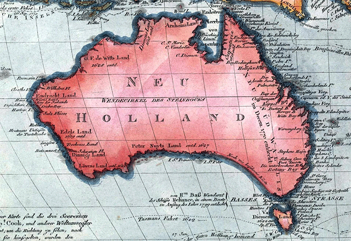
1802 map of Australia. Believed to be one of the first maps that separated Tasmania from the mainland Neu Holland - 19th Century, Australia, Oceania
Radical Title is a concept used by the European Colonists to give the claimant Nation the first right to negotiate Treaties, Rentals or Purchases with the Natives ahead of other European (Christian) Powers. It is not a claim to the lands if they are already inhabited. Cook wrote many times about the people on New Holland.
The imperialist and colonial narrative depicts Cook as diligent, working class, precise and heroic. If he had such attributes then the purported Possession Island Proclamation attributed to Cook would have been an erratic action way outside of his Orders and outside of Cook's character. How come this is ignored?
The colonial narrative also conflates this proclamation supposedly made on Possession Island with British Sovereignty over Australia. The eastern half at least. There’s no evidence to support this contention but good reason for saying it . In the Instructions to Governor Phillip of April 1787 it states that he is to be Lieutenant Governor over “Our Territory called New South Wales” and then it marks out the extent of what is claimed to be British Territory. Thus, the story of Cook being the discoverer of some otherwise unknown (to Europeans) new lands, then becomes the basis for the second deception being a claim over the territory of New Holland and New South Wales shifts from a Radical Title claim to a coast, to a claim over territory.
As the highest imposed court determined in Mabo 2, 1992, these lands were treated as if a Terra Nullius. The British Crown claimed sole ownership over all of the lands.
The taught history had it that “Australia was discovered in 1770 by Captain Cook.”
I guess they've had to say something, but something other than the truth
- Graeme Taylor 13 December 2021
New Zealand: Aotearoa is the current Maori name for New Zealand and often translated as 'land of the long white cloud'
1. You can’t always trust what you read – John Hawkesworth’s ‘An Account of the Voyages … [of] Captain Cook
Tairawhiti Museum (New Zealand) https://bit.ly/3DsYjlj
2. Secret Instructions to Lieutenant Cook 30 July 1768 (UK)
[transcript - pdf] https://bit.ly/3y3fGrP
3. Captain Cook's Journal during his First Voyage Round the World made in H.M. Bark "Endeavour" 1768-71, Gutenberg eBooks https://bit.ly/3EA5Q3k
4. An account of the voyages undertaken by the order of His present Majesty for making discoveries in the Southern hemisphere. Library of Congress https://bit.ly/3y9xW2L
5. A letter from Mr. Dalrymple to Dr. Hawkesworth, occasioned by some groundless and illiberal imputations in his account of the late voyages to the south. by Alexander Dalrymple, State Library of NSW https://bit.ly/3pva4CW
6. The French map that showed a new world BY Martin Woods, Curator of Maps at the National Library of Australia. (Sydney Morning Herald) https://bit.ly/3pYw89t
7. European Voyages Of Discovery, Australia Discovered In The Sixteenth Century? by Des Cowley (State Library of Victoria) https://bit.ly/3dyaPW6
8. Royal Australian Historical Society 'Journal of proceedings' Vol XllV Part 1 - 1927 (NLA Trove Journals) https://bit.ly/3EHWQJA
9. Royal Australian Historical Society 'Journal of proceedings' Vol Xlll Part 1 - 1927 (NLA Trove Journals) https://bit.ly/3GwE8Fh

